Whale Watchers –  March 19, 2025 / Namiyo’s Birthday 

  • Kumano Kodo: Day 5 / Nachikatsuura to Hayatama-Taish Shrine
  • Distance:  13 mi 
  • Total mileage:  56.2 miles
  • Ascent:  764’ / Descent: 756’ Time: 8h 30m (moving 6h 10m)
  • Weather: 30-50°  /  sunny & winds 20-30 mph with gusts over 40mph

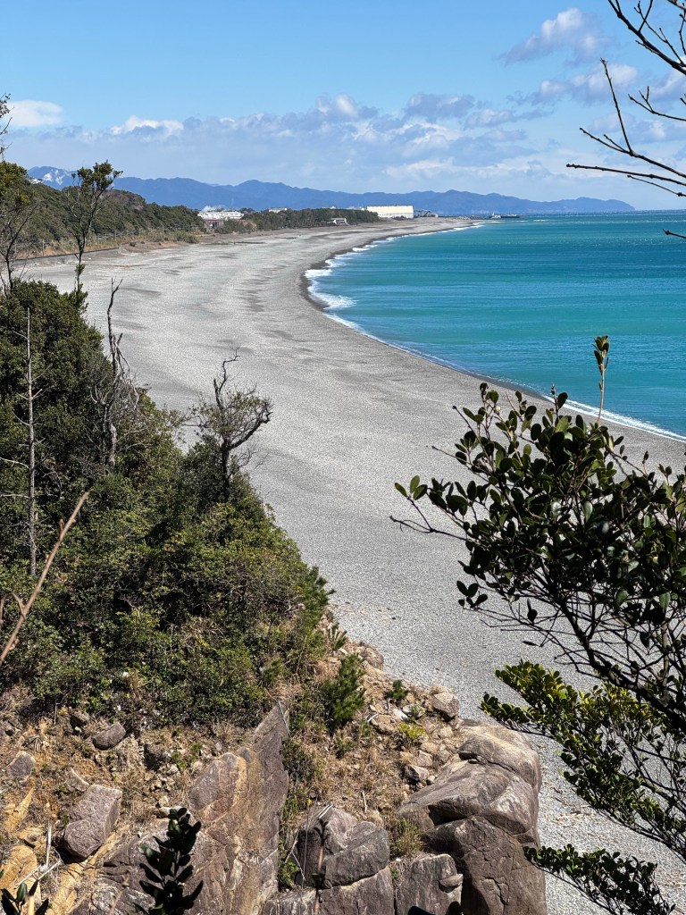
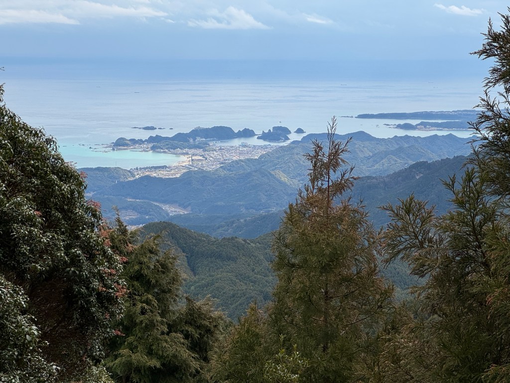
Whale watchers from this look out point sent smoke signals immediately after detecting a whale to inform people on the beach and fleet where the whales were. Can you imagine traditionally people got in the water to harpoon whales?

Whale Watching Lookout Point
Harpoonist in water!
Whale Lookout
Today no whales.

Bullet  Dodged –  March 19, 2025 / Namiyo’s Birthday 

  • Kumano Kodo: Day 5 / Nachikatsuura to Hayatama-Taish Shrine
  • Distance:  13 mi 
  • Total mileage:  56.2 miles
  • Ascent:  764’ / Descent: 756’
  • Time: 8h 30m (moving 6h 10m)
  • Weather: 30-50°  /  sunny & winds 20-30 mph with gusts over 40mph

OVERVIEW 

  1. Train: 10 minutes from Nachikatsuura to start of Kumano Kodo trail by ocean
  2. Walk: 13 miles / 8h 30m to Hayatama-Taish Shrine 
  3. Bus: 30 minutes Hayatama-Taish Shrine to Hongu-taisha (pick-up car)
  4. Drive: 30 minutes from Hongu-Taisha Shrine to Totsukawa

Bullet dodged as the mountain pass we crossed yesterday is now snow covered. Fortunately much of today’s walk is at sea level yet wind gusts of 40mph present a hardship. 

Mountain pass on horizon snow covered.
Temizuya, water pavilion for purifying mind and body.
Temizuya
Temizuya

Meeting the Departed –  March 18, 2025

  • Kumano Kodo: Day 4 / Koguchi to Nachi-taisha Shrine
  • Distance:  8.2 mi  Total mileage:  43.2 miles
  • Ascent:  3,670’ / Descent: 3,532’
  • Time: 8h 40m (moving 7h)
  • Weather: 35-53°  /  frost alert, partly sunny & winds 7-10mph

It has been said as pilgrims descend from Funami-toge Pass, they may see a figure coming towards them. As the figure approaches the pilgrim recognizes it as a deceased friend or relative. When the pilgrim begins to speak, the figure vanishes. Namiyo hopes she will meet her father. 

Nachi-Taisha Shrine
Tallest waterfalls in Japan. It is here to the three legged crow led Japan’s first emperor.
Nachi-Taisha Shrine
First cherry blossoms!

Impossible to Describe –  March 18, 2025

  • Kumano Kodo: Day 4 / Koguchi to Nachi-taisha Shrine
  • Distance:  8.2 mi 
  • Total mileage:  43.2 miles
  • Ascent:  3,670’ / Descent: 3,532’
  • Time: 8h 40m (moving 7h)
  • Weather: 35-53°  /  frost alert, partly sunny & winds 7-10mph

OVERVIEW 

  1. Walk Koguchi to  Nachi-Taisha Shrine  
  2. Bus from Nachi-taisha Shrine to Nachikatsuura
  3. Sleep at Nachikatsuura Guest House

In 1201 the famous poet Fujiware Teika wrote in his diary, “This route is very rough and difficult; it is impossible to describe precisely how tough it is.”  I couldn’t express it better. 

Saburo on the Kamano Kodo.
Descent or ascent but never walk on flat trails.
Pacific Ocean
Pacific Ocean

Japanese Woman –  March 17, 2025

  • Kumano Kodo: Day 3 /Hongu Taisha Shrine to Koguchi
  • Distance: 8.2 mi 
  • Total mileage:  32 miles Ascent:  1,797’ / Descent: 1,804’
  • Time: 5h 30m (moving 4h 15m)
  • Weather: 35-50° /  partly sunny & winds 10-20mph

This Japanese woman epitomized the friendliness and manners of its people. Even masked her eyes dances with joy. I had to bow to my knees to show her more respect than what she showed me. 

Eyes that dance with joy.
Eyes that almost dance with joy.
Jizo with eyes for children and traverses.

Wishful Thinking–  March 17, 2025

  • Kumano Kodo: Day 3 /Hongu Taisha Shrine to Koguchi
  • Distance: 8.2 mi 
  • Total mileage:  32 miles
  • Ascent:  1,797’ / Descent: 1,804’
  • Time: 5h 30m (moving 4h 15m)
  • Weather: 35-50° /  partly sunny & winds 10-20mph

Today’s clearer skies reveal Kumano Kodo’s mountains. I thought I was finally getting stronger walking legs until I discovered the mileage, ascent, and time were a fraction of the past days. Wishful thinking has thoughts of lower mountains, stronger legs.

Statuary from Temizuya, water purifying station before entering temple.
Looks familiar?
Magnificent views require strong legs.

7 Up, 7 Back –  March 17, 2025

  • Kumano Kodo: Day 3 /Hongu Taisha Shrine to Koguchi
  • Distance: 8.2 mi 
  • Total mileage:  32 miles
  • Ascent:  1,797’ / Descent: 1,804’
  • Time: 5h 30m (moving 4h 15m)
  • Weather: 35-50° /  partly sunny & winds 10-20mph

On the Camino Santiago there’s always 7 pilgrims in front of you. Pass those 7 and you have 7 pilgrims behind you and a new 7 pilgrims in front of you. We may see 3 dozen people a day walking the Kumano Kodo. They are never in our eye sight for more than 5 minutes until one of us is gone. 

From Tokyo. Exactly my age! There are few people older than 50 walking the Kumano Kodo. Most people seem between 25 and 35.
White Flower
Jizo protects the souls of children as well as travelers.
Plum Blossoms

Walk in Silence –  March 17, 2025

  • Kumano Kodo: Day 3 /Hongu Taisha Shrine to Koguchi
  • Distance: 8.2 mi 
  • Total mileage:  32 miles
  • Ascent:  1,797’ / Descent: 1,804’
  • Time: 5h 30m (moving 4h 15m)
  • Weather: 35-50° /  partly sunny & winds 10-20mph

OVERVIEW 

  1. Drive 30 minutes from Namiyo and Saburo’s home in Totsukawa  
  2. Park car at Hongu Shrine
  3. Walk from Hongu Shrine to Koguchi 
  4. Sleep at Koguchi

 I quickly remember why I enjoyed walking the Camino with Namiyo and Saburo. They walk in silence. For me, conversation disturbs nature’s beauty. 

Saburo
Saburo on switchback.
Namiyo
Rare glimpse of sunlight in the forest.

Simply Be Gone –  March 16, 2025

  • KumanoKodo: Day 2 / Nonaka to Hongu Taisha Shrine
  • Distance: 12.5mi 
  • Total mileage:  23.8 miles
  • Ascent:  2,117’ /Descent: 3,532’
  • Time: 7h (moving 6h)
  • Weather: 45-50° /  light rain and wind

It is hard to photograph the beauty of walking Kumano Kudo. The immensely straight and immensely tall cypress and cedar forest seem always at hands reach. The mountain slopes range 45-80°. Slip off the trail and you may easily roll out of sight and simply be gone.

Lethal drop off on left. Typical.
Immensely straight and tall cypress and cedar. Typical.
Barricade of trees. Typical.
Tree with flowers the size of my pinkie nail. Not typical.

Stamp –  March 16, 2025

  • KumanoKodo: Day 2 / Nonaka to Hongu Taisha Shrine
  • Distance: 12.5mi 
  • Total mileage:  23.8 miles
  • Ascent:  2,117’ /Descent: 3,532’
  • Time: 7h (moving 6h)
  • Weather: 45-50° /  light rain and wind

There are hundreds of minor temples supporting Kumano Sanzan, the three major temples. At each temple is a passport stamp station to document your visit. This entitles you for a Kumano Kodo certificate. It’s similarly to the Santiago de Compostelle Camino passport and certificate system. 

Added challenge is to keep passport dry in the rain. Password station is small house like structure.
Namiyo skillfully and simultaneously stamps Saburo’s and her passport at each station.
Runners and hikers jokingly said the miles done don’t count unless your watch is recording the event. Getting a stamp at each station gives you that same sense of ownership.
Arrived dripping wet at the Gate to Hongu Taisha Shrine. It’s our first of three major shrines collectively named Kumano Kodo Sanzan.